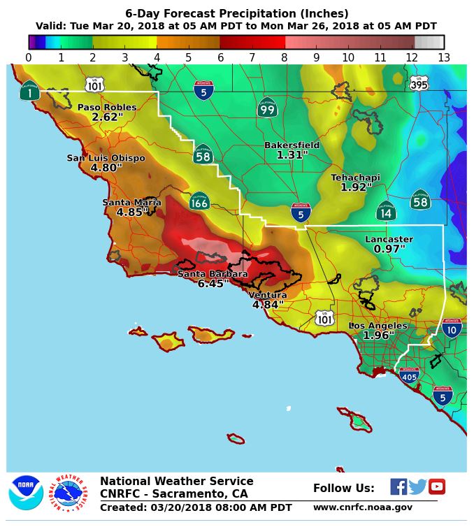
The National Weather Service (NWS), Los Angeles Office is warning the region that sustained heavy rains are incoming for the majority of the rest of the week. The beginning of the rain is set to arrive today (Tuesday) and last well into Thursday. The “atmospheric river” storm is expected to bring between 5 and 10 inches of rain in the foothills and mountains, significantly more total rainfall than the 1/9 debris flow, which brought between 3 and 6 inches to the region. The NWS says this storm is projected to have the heaviest rainfall and the longest duration of this winter storm season. “All models indicate high confidence in rainfall totals and the duration of the storm.”

National Weather Service Precipitation forecast for the Greater Los Angeles and Santa Barbara Areas through the weekend. Recent Fires are seen in black on the map as worry grows about debris flow potential.
Debris Flow Risk for Santa Barbara County Burn Areas
We caught Monday’s press conference from Emergency Officials with Santa Barbara County, who are stressing the seriousness of the renewed threat flooding and especially of debris flow. Opening the discussion, Meteorologist, Mark Jackson warned, “A key worry with this storm is rainfall rates that can trigger debris flows. It’s not necessarily the total amount of rain that occurs; it’s how fast that rain falls.” Well, the latest meteorological models by the National Weather Service indicate that there is potential for rainfall intensity of between .5 to .75 inches per hour, which is enough to trigger debris flows at any time during the storm.

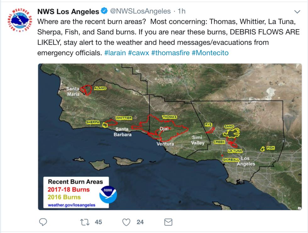
NWS Los Angeles warning via tweet today that debris flows near recent fires are likely across the region
As a result, many residents downslope of Thomas and other fires in the region (seen as black in the map above & highlighted in the tweet below) have been evacuated or at least cautioned. Santa Barbara County is also managing and updating an evacuation map found here. In addition, Rob Lewin, director of the Santa Barbara County Office of Emergency Management, warned the amount of rain and the intensity is enough to cause flooding even without the impact of the recent fires. “We could experience localized flooding and road closures which are not isolated to the burn areas. The threat of rock falls, mud slides and debris flow is high,” he noted.
“A key worry with this storm is rainfall rates that can trigger debris flows. It’s not necessarily the total amount of rain that occurs; it’s how fast that rain falls.” – Mark Jackson, NWS Meteorologist
Storm Facts:
- Heaviest Rainfall for Ventura County to San Luis Obispo County is expected Wednesday afternoon to Thursday morning (March 21 – March 22)
- Heaviest Rainfall for LA County is expected Thursday into Thursday Night (March 22)
- Rainfall totals for the Coasts/Valleys will be 2-5 inches, for the Foothills/Mountains more like 5-10 inches.
- Flash flooding and significant debris flows near recent burn scars are likely
- Urban and small stream flooding expected
- Slight chance of main stem river flooding
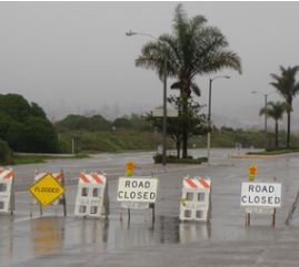
- Road closures anticipated due to rock fall in the mountains
- Residents in the Extreme and High Risks areas of Santa Barbara County are required to evacuate at noon on Tuesday (March 20)
- Mandatory evacuations prompted for areas below the Thomas, Whittier, and Sherpa Fires
Sources:
National Weather Service
Santa Barbara County Emergency Services


