Brian Head Fire Summary
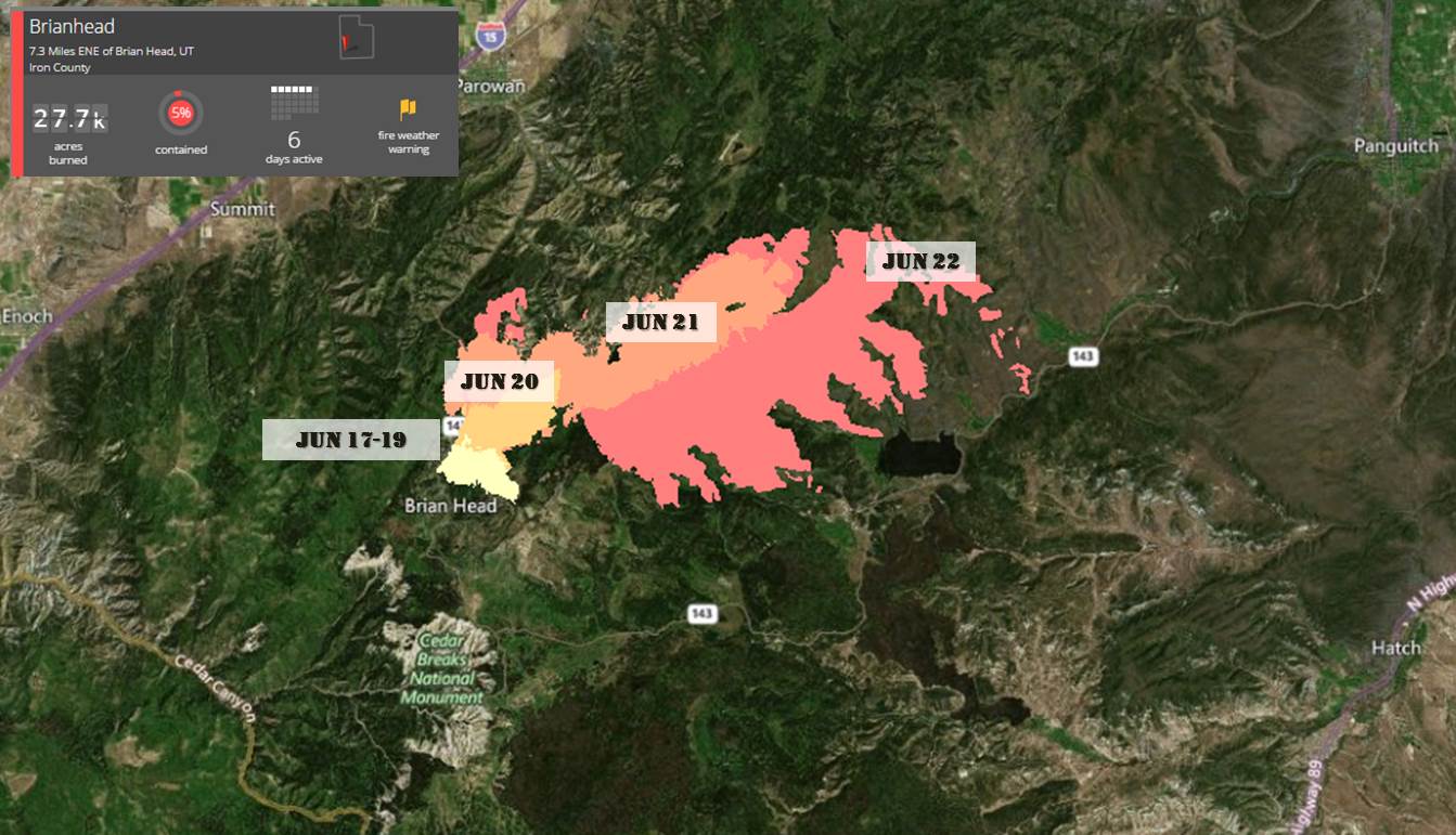
The Brian Head fire started around noon on Saturday, June 17th along State Road 143, north of the Utah resort town of Brian Head. RedZone first learned of the fire at 50 acres with evacuations reported on the north and northeast ends of town. Multiple pictures surfaced that afternoon as the fire grew to 500 acres and dangerously close to town, eventually prompting an expanded evacuation of the entire town around 3pm. A type 3 team assumed command of the fire Saturday evening and gave way to the Great Basin Type 2 Incident Management Team 4 (Roide) at 6 AM, Monday, June 19. Roide’s team has had command ever since. Due to the evacuation situation, remote location, and lack of radio traffic, the extent of Saturday and Sunday’s fire growth wasn’t known until the first official perimeter came out Monday morning. That perimeter, shown in yellow in the map below, first put the fire at 957 acres, having also burned four homes in north Brian Head during those first 36 hours.

Brian Head Fire Progression Map (Operational Periods of 6/19 to 6/22)
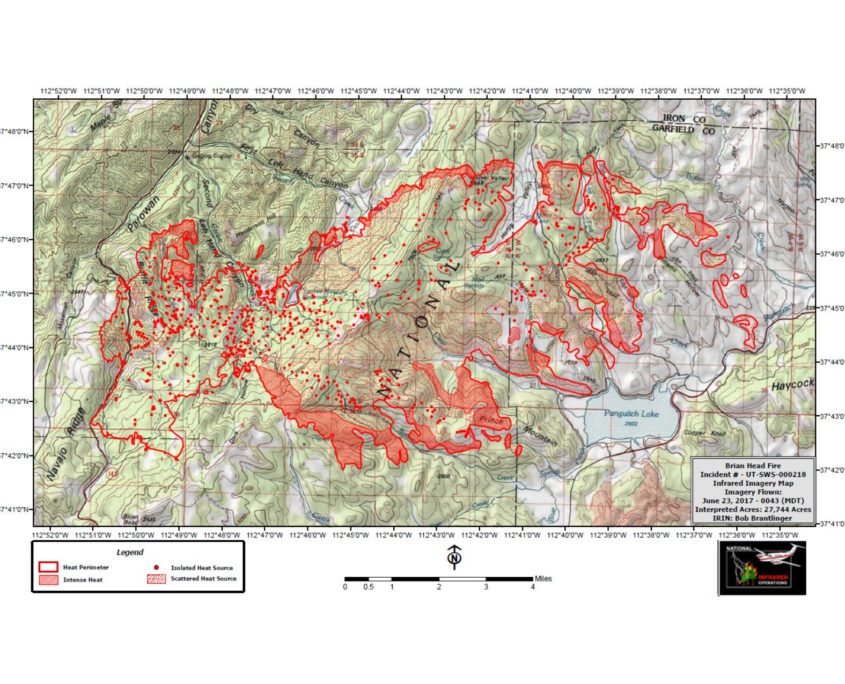
As strong high pressure moved into the area early in the week, the fire picked up steam on the north side and ran north and east growing quickly through dense timber. The Brian Head fire nearly tripled in size each day starting Monday recording roughly 2700 acres Tuesday, 10,000+ acres Wednesday, and over 27,000 acres this morning (6/23). During yesterday’s 17,000-acre run, more structures were lost and much of the Panguitch Lake area along the eastern portion of SR 143 was added to the growing mandatory evacuation list. Prevailing winds were pushing the fire north and east until late in the afternoon on Wednesday when winds shifted the fire in a new, southeasterly direction. Clear Creek and Horse Valley were impacted and nine additional residences and six outbuildings were lost. This brings the total number of structures lost to 13 residences and eight outbuildings.

Thursday Morning’s IR Map from the Brian Head Fire
Brian Head Fire Outlook
Containment is still only 5% with red flag conditions continuing again today and is forecast again tomorrow. Fire officials are projected 2-3 miles of more growth to the southeast and northward down SR 143. Weather concerns are abundant as dry conditions are forecast to continue through Sunday with ongoing well above normal temperatures, low RH, and very unstable atmospheric conditions. There are 11 helicopters, 34 engines, and 23 crews for a total of 809 firefighters on scene. Full containment is not expected until July 5th.
Brian Head Fire Facts
- As of: June 23rd, 2017
- Location: Brian Head, UT
- Size: 27,744 acres
- Containment: 5%
- Fire Behavior: Extreme fire spread with spotting and dangerous rate.
- Structures Threatened: Yes
- Structures Destroyed: 13 residences and eight outbuildings
- Evacuations: All of Brian Head, UT. Horse Valley, Clear Creek, Beaver Dam, Blue Springs, Panguitch Lake Campgrounds, Mammoth Springs Campground, Rainbow Meadows, and Mammoth Creek.
- Incident Page: http://inciweb.nwcg.gov/incident/5253/
- News Article: Desert News Utah
Sources: Inciweb, Desert News Utah, Utah Fire Info, NIFC


