Southern California:
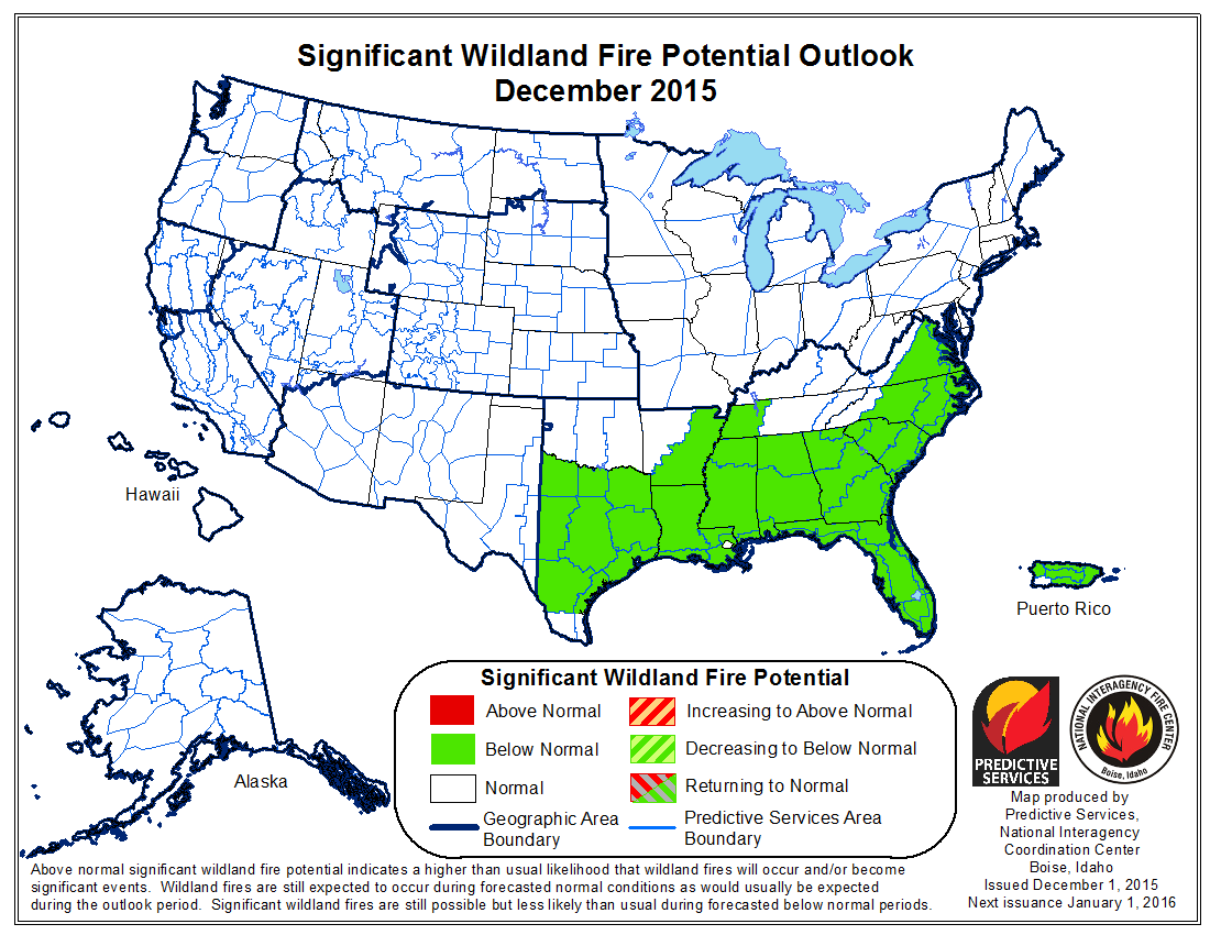
Normal significant wildland fire potential is expected for Southern California for the outlook period.
Weather and Fuels:
After a relatively wet early October, the weather over much of the area turned warmer and drier during the second half of October and into November. A strong ridge of high pressure over the Eastern Pacific kept the storm track well to the north. At the same time, several troughs to the east of the state allowed periodic offshore wind episodes to occur. Most of these were of light to moderate intensity and of short duration. Some wetting rains and high elevation snowfall occurred over portions of Central California, but most of Southern California saw little precipitation during the second half of October into the first half of November. The combination of offshore winds and warm ocean temperatures pushed many locations across Southern California into monthly maximum temperatures records. Fuel conditions vary from seasonally wet to extremely dry across the area. Most of the Sierras and higher elevations of the mountains of Southern California have seen several significant precipitation events, and with the short daylight hours and low sun angle, it would be difficult for these areas to see any additional significant fire activity this year and into early 2016. However, the dry weather allowed for a recent grass crop to cure across portions of Southern California. In general, eastern Santa Barbara County southward to Orange County are the driest parts of the area. These areas continue to see very low dead fuel moisture due to the very warm and dry weather.
Long range models depict a change in the weather pattern over the next few weeks. A much more progressive pattern seems to be shaping up over the Pacific. Additionally, the El Niño over the Eastern Pacific is likely peaking in intensity. As the east to west trade winds continue to weaken and convection increases across areas of the Eastern Pacific, storm frequency should increase in December. Significant and potentially heavy rain will accompany some of these storms. Large fire potential should be near normal early in December over the remaining dry areas.
Northern California:
Normal significant wildland fire potential is expected for Northern California for the outlook period.
Weather and Fuels:
November precipitation ranged from 50 to 125 percent of normal over most of northern California, with temperatures that were near normal to 5 degrees below normal. This helped get the early phases of a high-elevation snowpack get started. Fire Danger / Potential was down to near zero in the Northwest quarter of the Geographic Area and the roughly once-per-week storms elsewhere, each with light to moderate precipitation, sufficiently to greatly reduced fire potential.
For December, near-normal precipitation is expected, with temperatures near to a little above normal. The strongest El Niño in 18 years will affect the jet stream patterns, such that it is expected that northern California will have a good chance of receiving above normal precipitation for the three month period from January through March. Higher elevation snowpack should be the best in at least the past several years, and mid-elevations will see some snowpack (in contrast to the past two winters when there was very little).
http://www.nifc.gov/nicc/predictive/outlooks/monthly_seasonal_outlook.pdf
![]()


